Home Page
About the RCA
What's On
Magazine/Directory
For Women
For Children
For Senior Citizens
Good Neighbours
Sport and Fitness
Local Festivities
Cultural and Social
Health
Local Government
Religious Activities
Village Design
Gallery
Local Businesses
Local Pubs
Charities
Political Groups
Halls for Hire
Other RC Activities
Local Music Activities
Places to Visit
Contact Us

Landscape Character Assessment:
Nature Walks

If you'd like to join a walk and did not put your name on the walk lists at the Fair then please contact either Peter or Chris (see below) and let us know!  

WALK 1 - Parish landscape, woodlands, and the Staunton Park reservoir site.  Saturday 16th July, 2011, 10a.m.

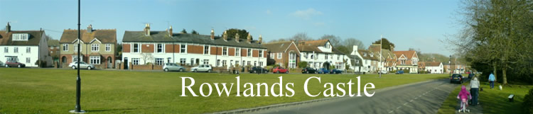
Meet at the flagpole on RC village green for a circular walk via the Golf Course, Havant Thicket, Gypsies Plain, the allotments and Oaklands to view the landscape in and adjacent to the village, local woodlands and the proposed reservoir site. Approximately 5km (3 miles).

WALK 2 - Rowlands Castle, its geology and archaeology.  Saturday 6th August 2011, 10a.m.

Meet at the flagpole on RC village green for a circular walk via Finchdean Road, Great Wellsworth, The Holt, Motleys Copse and Links Lane.  You’ll learn about the sinkholes, swallow holes, woodlands and archaeological features. An optional additional loop from Great Wellsworth to Whitehill will cover interesting access and archaeological features. Approximately 7km (4.5 miles) or 8.7km (5.5miles) including the additional loop.

WALK 3 - Finchdean, the Hangers and St. Huberts. Saturday 20th August 2011, 10a.m.

Meet outside The George Inn at Finchdean for a circular walk via St. Huberts Church, the hangers and chalk downlands around the upper Lavant Valley, also looking at Idsworth Farm and the church. An optional additional loop from Idsworth to Chalton will investigate the chalk downland further. Approximately 4km (2.5 miles) or 8km (5 miles) including the additional loop. (Note: there some steep gradients up to the hangers and open downland).

WALK 4 - Lavant Valley to Maize Coppice Farm.  Saturday 3rd September 2011, 10a.m. 

Meet at the flagpole on RC village green for a return linear walk to Maize Coppice Farm along Lavant Valley South, looking at Woodberry Lane ford, swallow holes and archaeological features. Approximately 4 km (2.5 miles).  (Note: may be cattle in fields).

The walks are generally level on footpaths or pavements.  Some sections may be a bit muddy or overgrown so stout shoes and trousers are advised.  All the walks involve crossing some roads and/or walking on short road sections – so, please take care!

Contact & additional Information: Peter McDowell (92412338) email Peter and Chris White (92412060). Email Chris.